I worked up the final map and itinerary for the day of the drive:
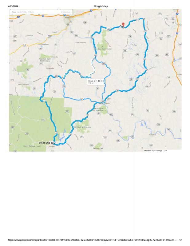
Early Summer Southeastern Ohio Driving Meet Directions
June 28th 2014
Meet at the Banana Peel diner located on RT 83 just a little south of Interstate 70 at 11:00AM
Everyone is encouraged to have lunch, refreshments or ice cream at the diner to thank them for allowing us to use their business as a rally point.
Drive begins at approximately 11:30AM
Turn L on RT83 (N)
Turn L on Sunflower Rd
Turn R on Pleasant Hills Rd
Turn L on Rix Mills Rd
Turn L on RT313 (E)
Turn R on RT83 (S)
Turn R on RT78 (W)
Photo Op at Big Musky Bucket (gravel drive and parking, stay to side of drive to avoid scraping if lowered)
Turn R on RT78 (W)
Follow RT78 through McConnelsville and cross bridge (obey speed limit and rally beyond bridge to regroup)
Continue on RT78 (W) towards Glouster
Photo Op at Burr Oak State Park
Turn R on RT13/RT93 (N)
Turn R on RT669 (E)
Follow RT669 To Muskingham River and Retrace to RT555 (dotted area on map, turn around to retrace may be awkward but worth it)
Turn L on RT555 (S)
Turn L on RT37 (E)
Follow RT 37/RT78 across bridge into McConnelsville (obey speed limit)
Turn R on RT60 (S)
Go short distance and bear L at Y onto W Jefferson Ave
Follow to traffic light
Turn L on RT 376 (N)
At intersection of RT60 and RT376 is the North Star restaurant which is a possible place to stop for food drinks and conversation.
Turn R on RT60 (N)
Anyone wanting to end the drive may take RT60 north through Zanesville and catch I70.
Anyone wanting more driving can take RT60 north to Mill St in Duncan Falls (first street on right past traffic light) and Turn R
Turn R on RT146 (E)
Bear L on RT313 (E)
Turn L on RT83 (N) to I70
Expected duration approximately 3 hours plus stops.